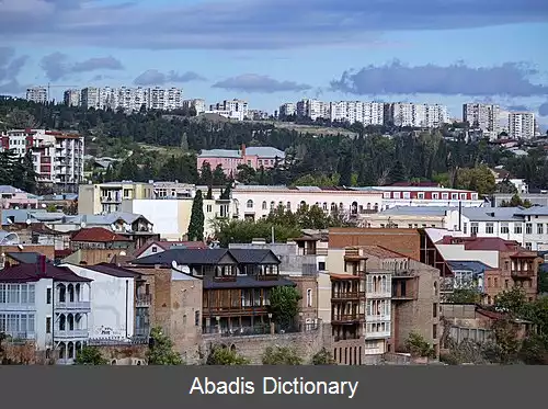
دورنمای شهری. دورنمای شهری که خط آسمان ( Skyline ) هم نامیده می شود چشم انداز بلندترین ساختمان ها و سازه های شهرهای دارای آسمان خراش است که از دور و در زمینه آسمان دیده می شود.
دورنمای ویژه هر شهر معمولا به عنوان امضا و شناسه هر شهر بزرگ به شمار می آید.
... [مشاهده متن کامل]
خط آسمان خیابان ها [ویرایش]
خط آسمان خیابان ها حد فوقانی تاج ساختمان ها و فصل مشترک کالبد خیابان با آسمان است. این خطوط خط پایه و خط ترکیب از اجزای خط آسمان هستند. خط پایه حدفوقانی جداره قائم بنا است و خط ترکیب حد نهایی جداره عقب نشسته یا مرز بام قابل رویت درزمینه آسمان است.
این عنصر کالبدی شامل مجموعه احجامی است که در ترکیب بام بناها با ابنیه بلندتر مستقر در پشت جداره دیده می شود. عنصرکالبدی خط آسمان، تجلی گاه ترکیب فرم در کالبد خیابان به شمار می رود و نماد نظم یا تنوع در سیمای خیابان است. [۱]
منابع [ویرایش]
↑ معماری خیابانی وهویت سیمای شهری در ایران/دکتر کامران ذکاوت
معماری خیابانی وهویت سیمای شهری در ایران/دکتر کامران ذکاوت
رده های صفحه: آسمان خراش هاشهر
قس عربی
خط سماء
من ویکیبیدیا، الموسوعة الحرة
غیر مفحوصة
خط سماء مدینة سان باولو
خط السماء ( من الأنجیلیزیة Skyline ) هو الصورة ( أو السلویت ) الناتجة فی السماء من رسم خط خارجی یُحیط بالأشکال المبینة للمدینة ، أو بالأحرى من الأجزاء العلویة للبیئة المبنیة.
تصنیفان: ناطحات سحاب هندسة المدن
قس انگلیسی
A skyline is the overall or partial view of a city's buildings and structures against the sky. It can also be described as the artificial horizon that a city's overall structure creates. Skylines serve as a kind of fingerprint of a city, as no two skylines are alike. For this reason news and sports programs, television shows, and movies often display the skyline of a city to set location. The Sky Line of New York City was a new term in 1896, when it was the title of a color lithograph by Charles Graham for the color supplement of the New - York Journal. [1]
The skyline of Hong Kong
Paul D. Spreiregen, FAIA, has called a skyline "a physical representation [of a city's] facts of life . . . a potential work of art . . . its collective vista. "[2]
In general, larger cities have broader and taller skylines, though lower density cities often have smaller skylines than expected for city size. [citation needed] Taller buildings are found where either land value or desire for visibility is higher, and the tallest buildings in a city are usually office buildings. [citation needed] Because of this, the skyline of a city can be seen as symbolic of the city's influence and economy. [citation needed]
[edit]See also
Cityscape
List of cities with most skyscrapers
[edit]References
^ New York Public Library: "Moving Uptown": "When Charles Graham's view of New York was published, the new term used in the title, "sky line, " caught on immediately. "
^ Paul D. Spreiregen ( 1965 ) . Urban Design: The Architecture of Towns and Cities. McGraw - Hill.
[edit]External links
Wikimedia Commons has media related to: Skylines
Di Serio's top 15 Skylines
The Skyline Project has a collection of skyline photographs from across the United States.
The World's Best Skylines calculates ranking by height and breadth of skylines.
All About Skyscrapers
Tallest Cities of the World calculated ranking strictly by height.
Emporis ranking of cities by the visual impact of their skylines
Skyline on m - w. com
Skyline Whitespace Exhibitions
View page ratings
Rate this page
What's this?
Trustworthy
Objective
Complete
Well - written
I am highly knowledgeable about this topic ( optional )
Submit ratings
Categories: CityLandscape artSkyscrapersArchitectural terminology
قس آلمانی
Skyline ( englisch „Himmelslinie“ oder Silhouette ) ist die Teilansicht oder das Panorama, das eine Stadt mit ihren höchsten Bauwerken und Strukturen vor dem Horizont abzeichnet.
Skylines sind etwas wie ein Markenzeichen, bzw. können „das“ Merkmal einer ( bestimmten ) Stadt sein. Eine wichtige Rolle im Erscheinungsbild einer Skyline spielen heute die „Skyscraper“, die Wolkenkratzer. Früher waren die Türme der Stadtbefestigungen und in Europa Kirchenbauten oder Kirchtürme, im islamischen Kulturkreis Minarette prägend für die Stadtsilhouette.
Skylines voller Wolkenkratzer gelten weltweit als Zeichen wirtschaftlicher Dynamik. In der Liste der Städte mit den meisten Großgebäuden liegt Hongkong mit 7. 659 registrierten Hochhäusern vor New York City mit 5. 571 Wolkenkratzern und São Paulo mit 4. 803 fertigen Hochhäusern ( bei dieser Zählung werden Fernsehtürme, Stadien, Kirchen und Moscheen nicht berücksichtigt ) .
Chicago gilt als Geburtsort der Wolkenkratzer, da hier mit dem zehnstöckigen Home Insurance Building 1885 das erste Haus mit Stahlskelett errichtet wurde. Am South Wacker Drive steht das höchste Gebäude Chicagos, der Willis Tower ( früher Sears Tower ) , der eine Zeit lang auch das höchste Gebäude der Welt war.
Inhaltsverzeichnis [Verbergen]
1 Geschichte
1. 1 Mitt . . .